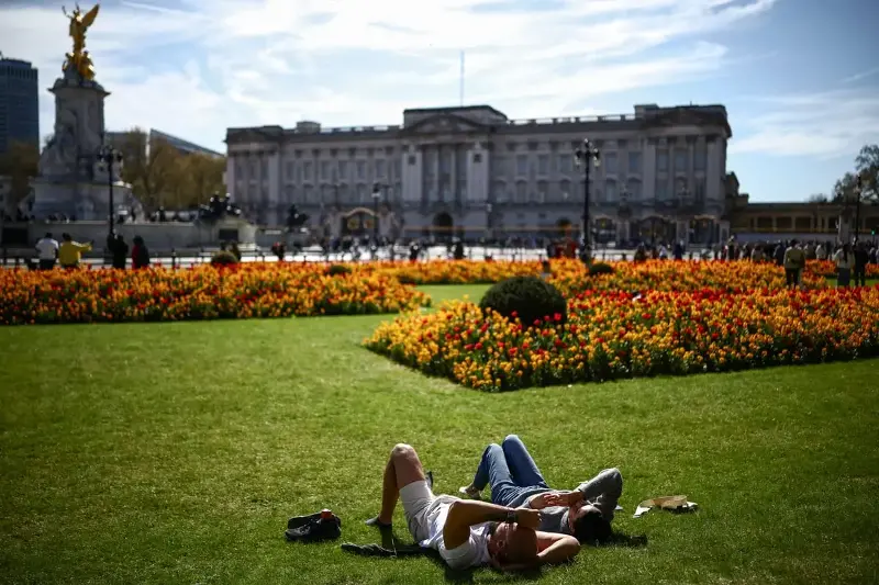
London could be hotter than Ibiza this week as weather forecasters suggest the UK could be in for the warmest start to April in six years.
Temperatures could climb to highs of between 18C and 23C across the country on Tuesday, with the Met Office currently predicting the capital may see around 20C. Wednesday and Thursday could see highs of 25C and 22C, respectively.
The hottest day of the year so far in London was recorded on March 18 when the mercury hit 20.1C - with this high set to be easily exceeded on Wednesday.
BBC Weather predicts Ibiza, popular with British tourists at this time of year, will also reach highs of 19-20C today, followed by 22C on Wednesday and Thursday.
Met Office meteorologist Greg Dewhurst said the weather was “unusually warm” for this time of year. The early April average is around 12C to 15C.
Mr Dewhurst said: “The wind is coming in from a southerly direction, and with not many clouds around, it should be well above the early April average.
“The last time we saw similar temperatures this time of year was in 2020, when we reached 26C in Cornwall.”
Parts of wester Wales may experience 24C today, going above the record UK high so far this year, which was 20.9C recocring in Pershore, Worcestershire.
The warmer weather is then likely to be followed by a “big change” on Thursday, with temperatures dropping to between 10 and 13C nationally.
“It’s all purely down to wind direction at this time of year,” a Met Office spokesperson said.
“For the next couple of days we’re dragging in that warm, southerly wind, which will allow us to see temperatures reach the mid-20s.
“As we go into Thursday, we’ll see temperatures return to normal for the time of year as we see the weather turn more changeable with advances of rain and showers.”
A warning for ‘very high’ pollen is also in place today and the rest of this week. Hayfever sufferers may experience itchy red eyes, blocked noses and sneezing.
The warmer weather comes after Storm Dave, which caused damage and disruption over the Easter weekend. High 70mph winds battered parts of northern England, Wales, and Scotland.
In its long-range weather forecast, the Met Office said the first part of the period from April 11 to April 20 will “remain rather changeable” with “showers or occasional longer spells of rain affecting many areas”. Drier interludes are possible, but temperature will most likely be close to normal.
The Met Office said: “Beyond mid-month, high pressure may become rather more dominant, bringing more in the way of drier and perhaps warmer weather, though this will be determined by the location and proximity of where any high is positioned relative to the UK.”
© The Standard Ltd